
When Are As-Built Drawings Mandatory for BC Permits?
Permit TriggersMunicipal plan examiners require professionally drafted As-Built plans in four common project scenarios:
- Missing Municipal Archives: Local city archives have no original blueprint records on file for older homes and buildings.
- Past Unpermitted Modifications: Previous owners completed renovations without permits, causing existing city records to mismatch physical reality on site.
- Structural Alterations & Wall Removals: Coordinating structural engineer Schedule B letters requires verified bearing point locations, post heights, and floor joist spans.
- Commercial Change of Use & TIs: Landlords and municipalities mandate verified base building plans before reviewing mechanical, plumbing, and barrier-free accessibility layouts.
As-Built Survey vs. Legal Land Survey: Key Differences
Service ScopeHomeowners and contractors frequently confuse these two distinct services:
| Feature / Scope | LiDAR As-Built Base Plan (Canadian Blueprint) | Legal Land Survey (BCLS Registered Surveyor) |
|---|---|---|
| Primary Purpose | Internal/external building dimensions for renovations, additions, and TIs. | Legal property boundary lines, easements, covenants, and building siting. |
| What It Measures | Walls, door jambs, window headers, ceiling heights, stairs, plumbing chases, and beams. | Property corners, iron pins, grade elevations, curb lines, and municipal setbacks. |
| When Required | Mandatory for interior renovations, additions, suite legalizations, and commercial TIs. | Mandatory for new custom home builds, subdivisions, and foundation siting. |
| Output Deliverables | Dimensional PDF drawing sets, 2D AutoCAD .DWG baselines, and optional 3D Revit .RVT models. | Stamped BCLS Legal Survey Plan, Topographic Site Plan. |
Step 1: Scope Definition
Phase 01We confirm project square footage, site access, and required deliverables (standard 2D CAD spatial baseline vs. full permit modeling) with an upfront, fixed-fee proposal.
Step 2: On-Site 360° LiDAR Scan
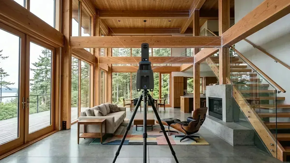
Phase 02Our scanning technician captures visible interior geometry using an iGUIDE PLANIX Pro (time-of-flight LiDAR paired with a Ricoh THETA Z1 360° camera), achieving a typical measurement uncertainty of ±1 cm (~0.4 in) up to 40 m on clearly visible interior wall segments (at least 60 cm / 2 ft wide). Exterior measurements are confirmed by hand. Note that LiDAR scanning does not guarantee anything hidden inside walls, floors, or ceilings; narrow, cluttered, or reflective areas (such as glass and mirrors); or exact square footage.
Step 3: CAD Processing & Spatial Baseline
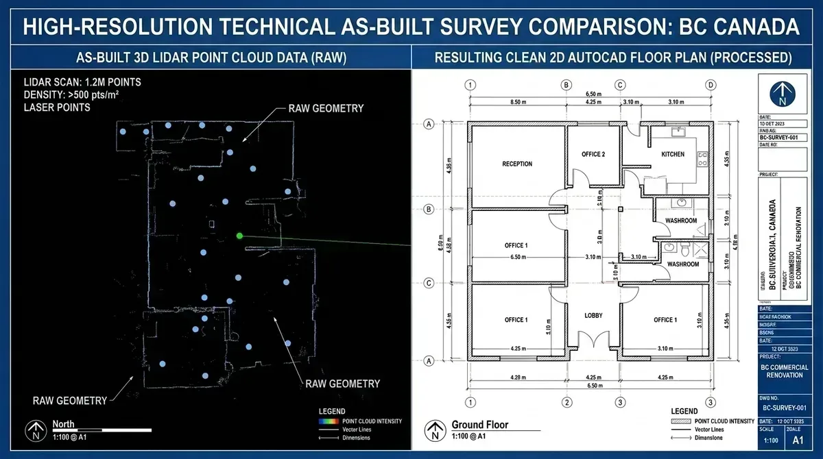
Phase 03We process scan data into 2D AutoCAD (DWG/DXF) spatial baseline files, ESX packages, 3D model exports, and dimensional PDF floor plans (±1 cm typical interior wall tolerance). If your project includes our full permit design package, our design team also authors complete, code-compliant 3D Revit models.
Step 4: Delivery (PDF, DWG & 360° Tour)
Phase 04We deliver final As-Built packages—including PDF floor plans, 2D CAD (DWG/DXF), ESX, 3D model exports, and interactive 360° virtual tours—giving your designer, engineer, or contractor a reliable baseline to draft permit drawings and coordinate construction.
Ready to Capture Your Existing Conditions?
Get StartedCanadian Blueprint delivers 360° LiDAR laser scanning (±1 cm typical interior wall tolerance) and permit base drawing packages for renovations and commercial tenant improvements across BC.
Prefer the process first? Read the 8-step approval guide As-Built Pricing Guide.

Canadian Blueprint Inc.
BC Building Design & Permit Drawings
